Moon Complex Fire Impacts on Rogue River
Written by Frances Oyung, Rogue Riverkeeper Program Manager, and Sydney Wilkins, KS Wild Conservation Attorney
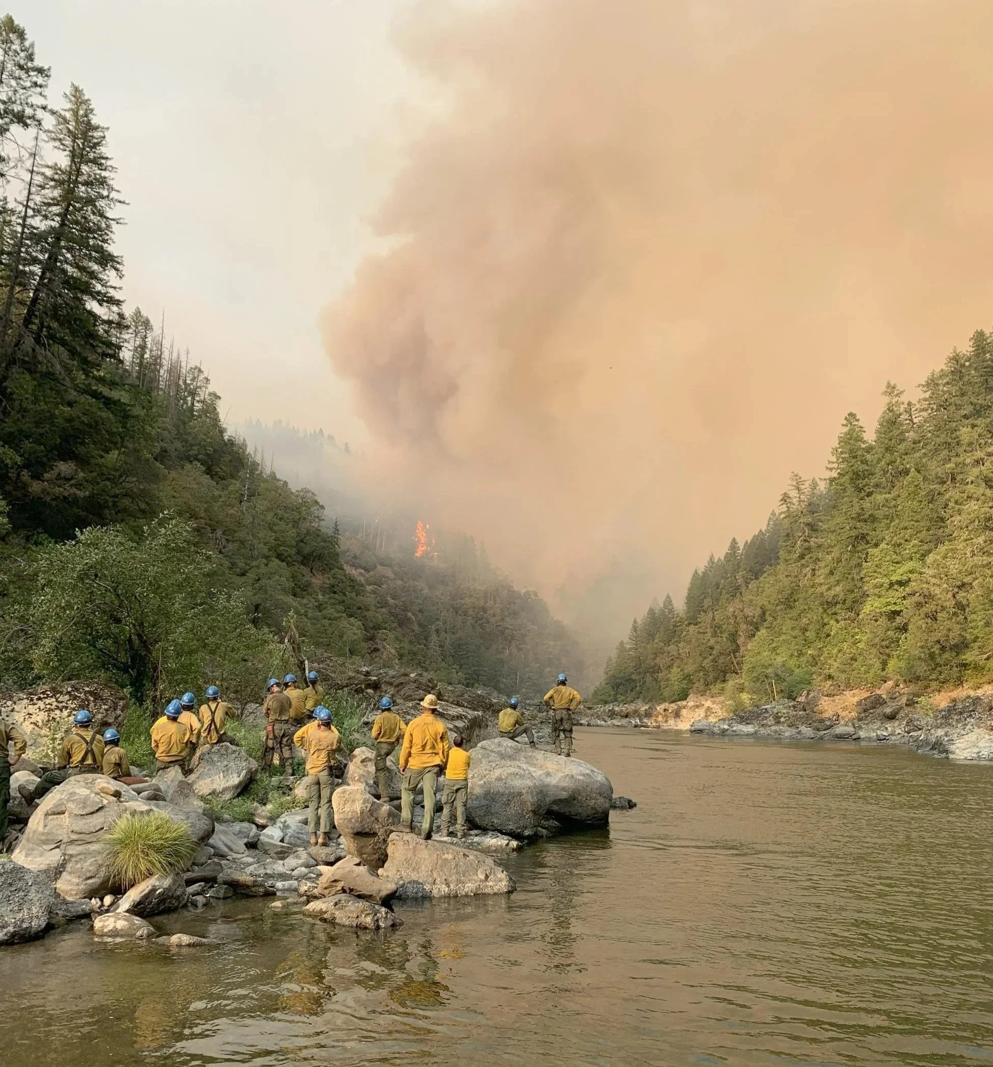
Firefighters watch the Moon Complex fire from the banks of the Rogue River. Credit: Inciweb
This past fire season, southern Oregon faced the Moon Complex fire, which ignited from lightning strikes in early September 2025. The fire burned across the Gold Beach, Powers, and Wild Rivers Ranger Districts of the Rogue River-Siskiyou National Forest, roughly 11 miles northeast of Agness. What began as five smaller fires—including the Backbone and Pinnacle fires—merged by the end of September into a large complex, burning upwards of 19,500 acres and impacting much of the Rogue River corridor, including areas within the Wild Rogue Wilderness and the Wild and Scenic River corridor.
By mid-November, Moon Complex was mostly contained, allowing communities and the Forest Service to shift focus to repair, recovery, and forest restoration. How these actions are done will have impacts to the river, ecosystems, and recreation of the area.
In mid-October, following standard practice, the Forest Service launched a Burned Area Emergency Response (BAER) assessment to better understand how the fire affected the landscape and determine present risks. The BAER team – consisting of soil scientists, hydrologists, and other specialists – evaluated soil burn severity, watershed conditions, and potential threats to public safety and natural resources.
Their findings showed that 81% of the burned area experienced low or very low soil burn severity, meaning much of the landscape could be expected to recover naturally. The assessment also identified potential concerns regarding post-fire conditions, including increased sediment runoff into waterways, higher peak flows during rainstorms, hazard trees, and increased risk of invasive species spread. The geography of the fire footprint, with steep terrain and much of it difficult to access, will have its particular challenges, both to the recovery, impacts, and options that the USFS might have available to address issues post-fire. The BAER team identified several values at “unacceptable risk,” including threats to human life and safety, damaged Forest Service roads and recreation infrastructure, and concerns regarding botanical and cultural resources.
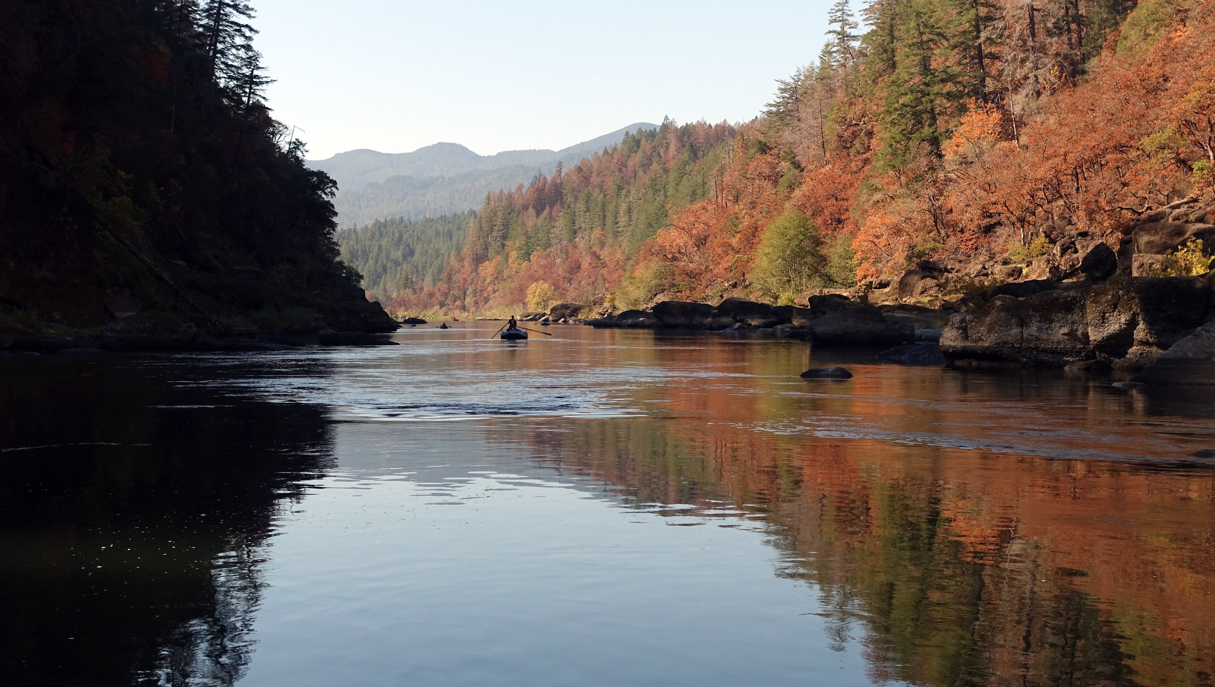
Photo taken Oct. 18, 2025 during the “mop up” phase of Moon Complex Fire. Brown leaves on oaks and other broadleaf trees seen in this photo are the result of the fire. Conifers in distance show both green needles and browned needles retained on trees. It remains to be seen how the Rogue will recover. Low severity fire can have positive impacts for ecosystems which rely on fire. Credit: Larry Orman
After a fire, there are many impacts to a landscape that come from the burning of vegetation, changes to the soil, and precipitation and runoff from the burned landscape. To reduce these risks, BAER specialists approved a series of treatments with funding requested to support the work.
Treatments recommended post-fire include:
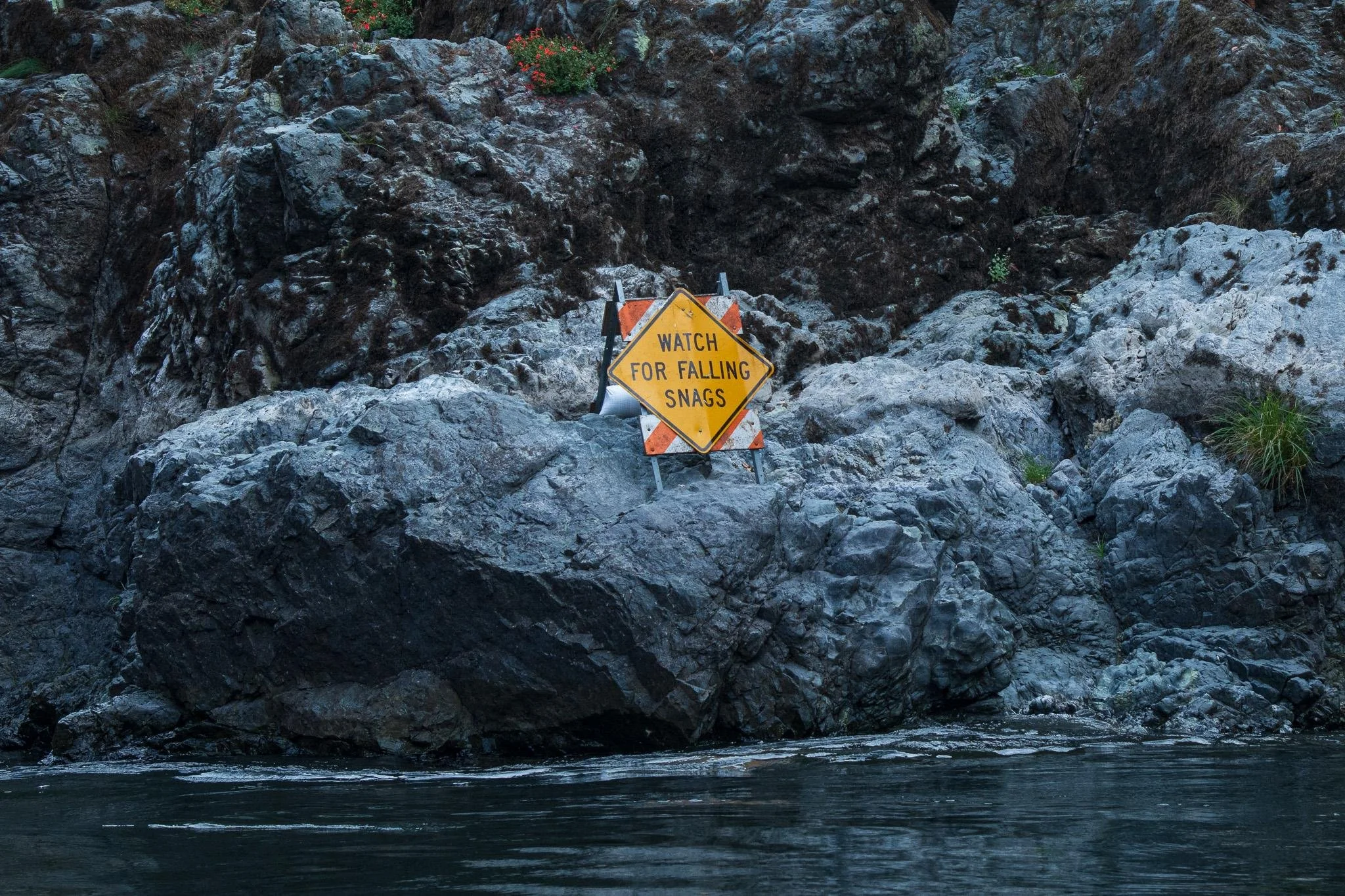
Hazard signage for boaters on the Rogue River. Credit: Inciweb
Reinforcing road drainage to reduce the potential damage from increased runoff by cleaning culverts and improving water flow paths to prevent washouts of roads which would result in the downslope movement of large volumes of sediment
Reducing erosion on slopes by placing woody debris and encouraging natural ground cover recovery to slow runoff which can improve infiltration and reduce scouring and sediment movement
Removing hazard trees along roads and trails to promote public safety
Monitoring burned areas for invasive species, with rapid response actions planned when invasive plants are detected
Recovery will take time, and the BAER report estimates that one to three years may be necessary for ground and canopy cover to return to pre-fire conditions in many areas. In some areas, it could take much longer.
Hazards to the public in the burned area include large green trees and burned trees with fire-damaged root systems that may fall at any time, unstable slopes with likely debris and rockfall, areas of the trail where retaining walls have been damaged, and six creek crossings that have damaged or destroyed foot bridges along the trail. The USFS states that work to stabilize the trail and rebuild retaining walls and bridges will be ongoing as conditions allow.

The current area closed to the public includes the Rogue River Trail from the Upper Mule Creek/Marial trailhead near the BLM boundary to the western end of the trail at the Big Bend trailhead upstream of Foster Bar as well as the Clay Hill Trail. The current closure order is expected to be rescinded mid-February and replaced by a new one and the trail will likely remain closed downstream of Paradise Creek initially though it is anticipated that at some point before the summer the trail will open up between Paradise Creek to Clay Hill. Opening the trail below Clay Hill depends on replacing 6 bridges at a cost of about $1.5 million and advocates are recommending that it will take a request of $3 million from Congress to get the trail restored.
It is important to respect road and recreational closures while recovery work continues as they are in place to protect your safety. Before planning any outings, verify the latest alerts from the Gold Beach Ranger District.
Post-fire recovery isn’t just about what burned: it’s about what happens next. By focusing on erosion control, water quality protection, and infrastructure safety, post-fire treatments are designed to help reduce the risk of secondary disasters and impacts, especially during heavy precipitation events. Targeted and appropriate actions can protect the ecosystems and waterways as well as the recreation values of the Rogue.

Learn more about fire in the region on the KS Wild page.